
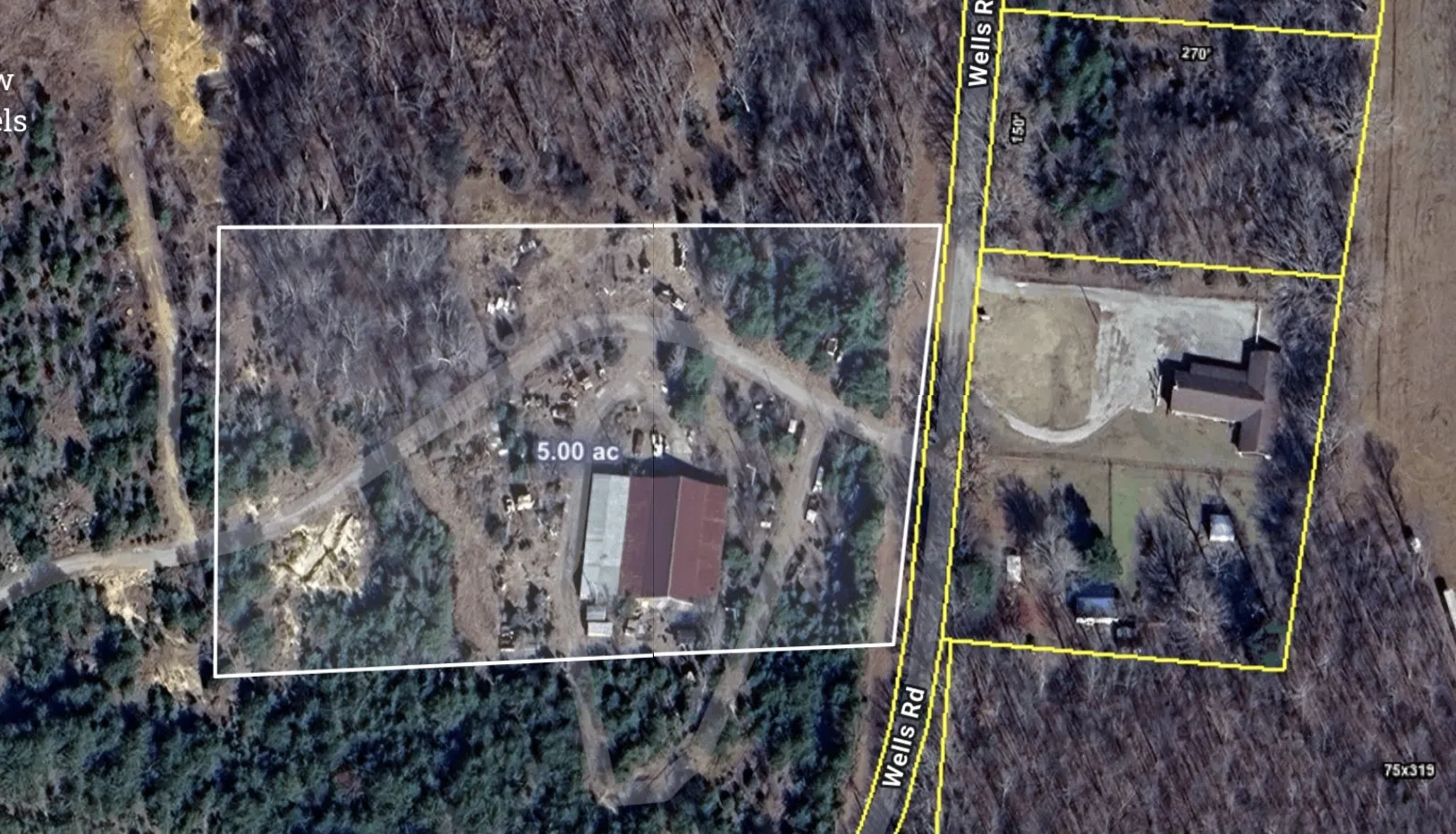
355 Wells Street, Monteagle, Tennessee 37356
TN, Monteagle-
Active Status
-
158 Dayz On Cribz Total Days
-
Farm Property Type
-
5 Acres Lot/Land Size
-
Mortgage Wizard 3000 Advanced Breakdown


Questions? Connect With Us!
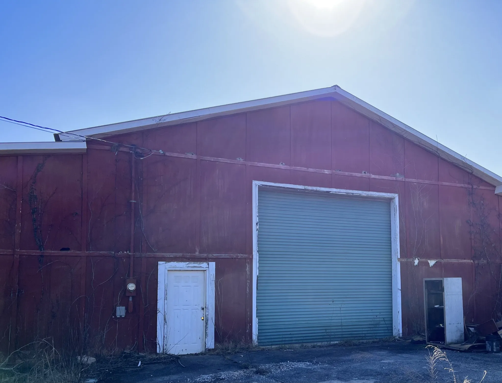
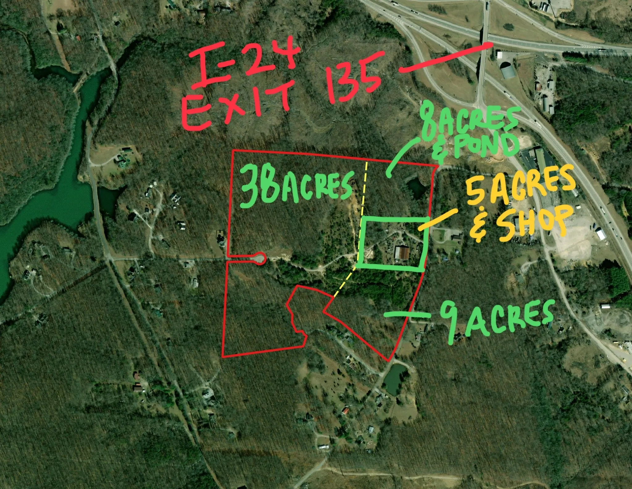
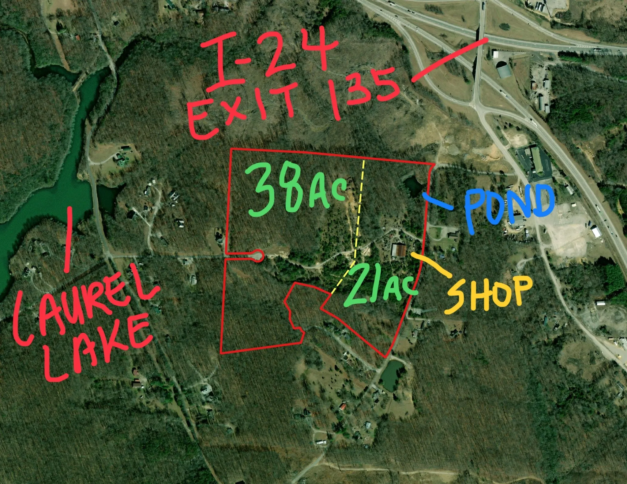
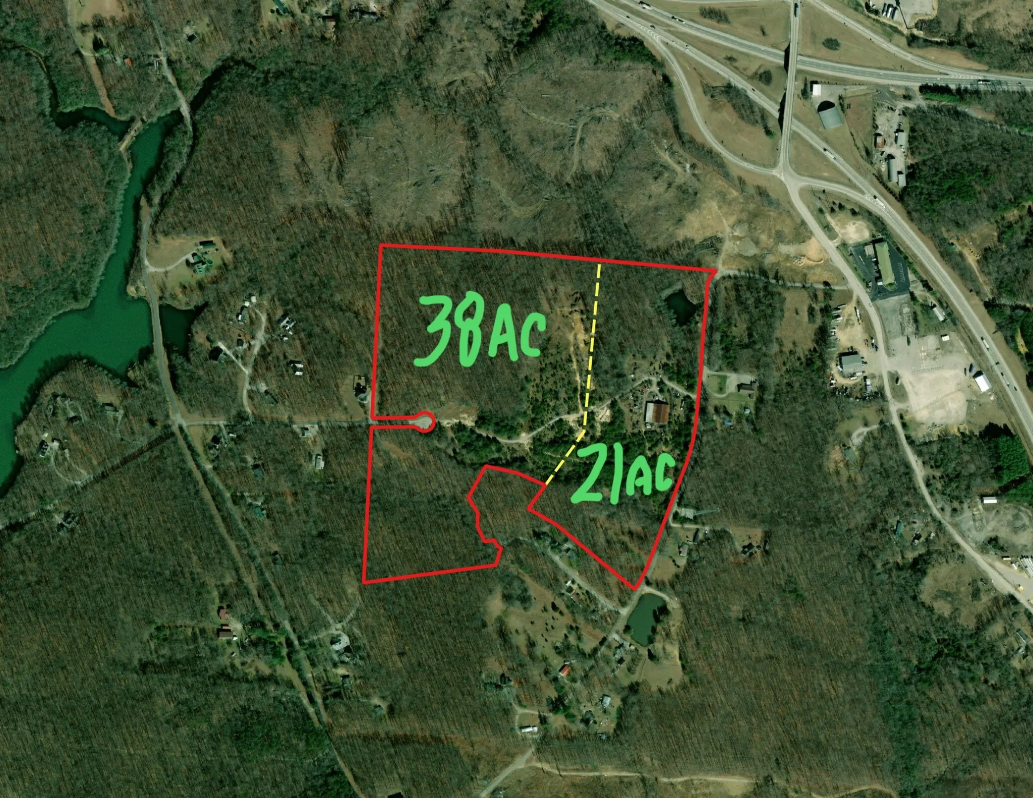
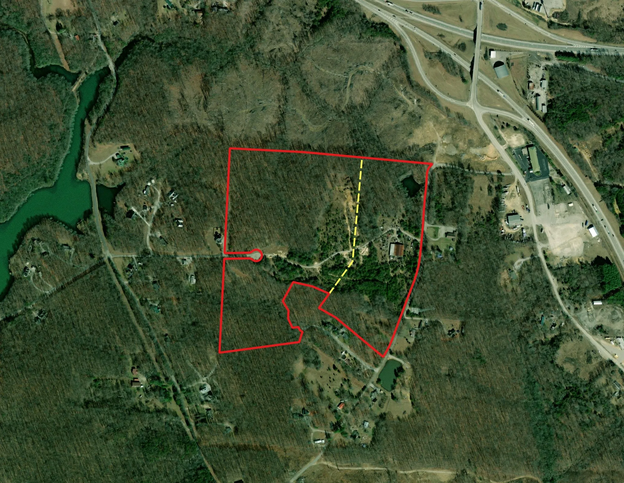
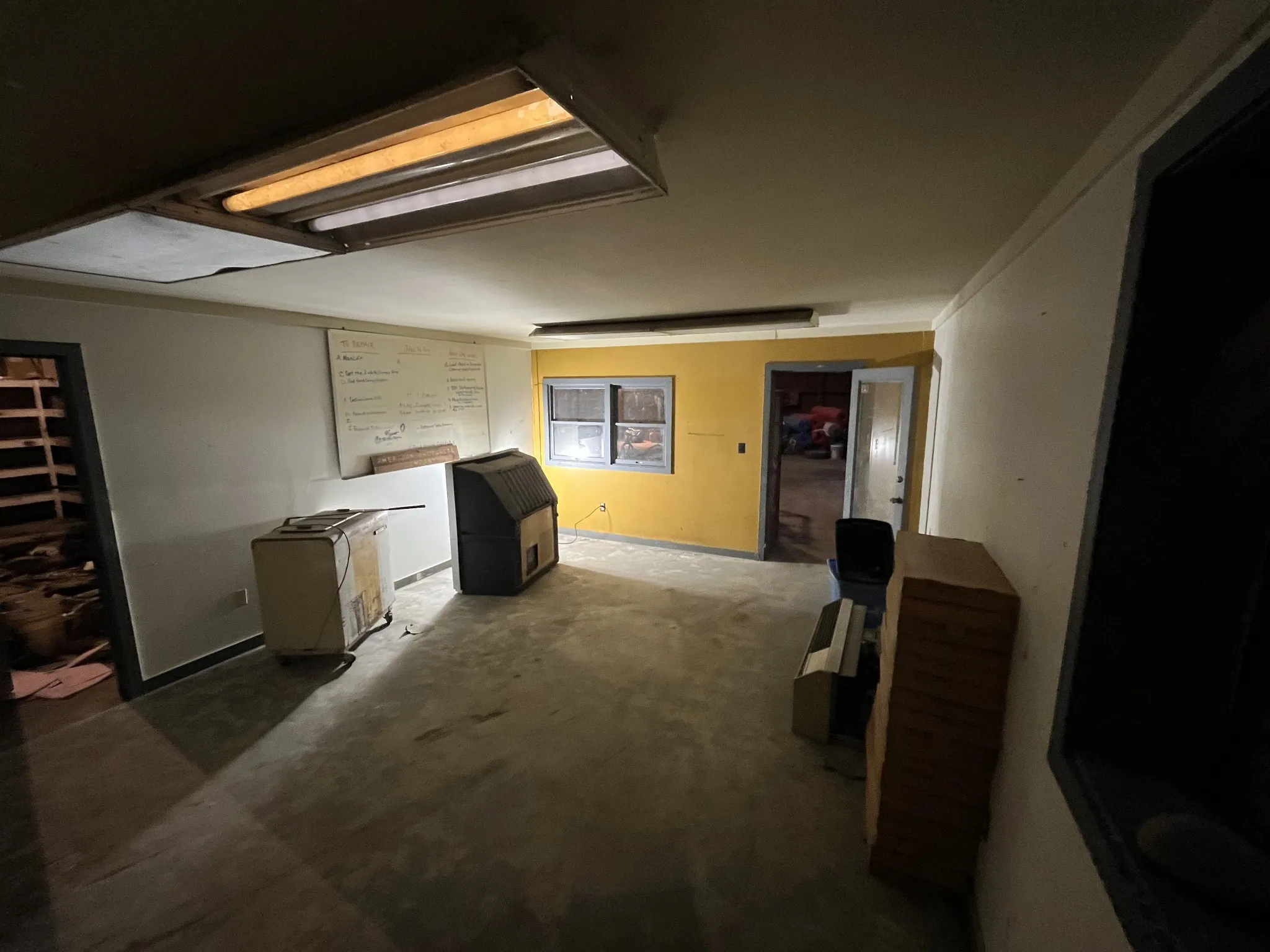
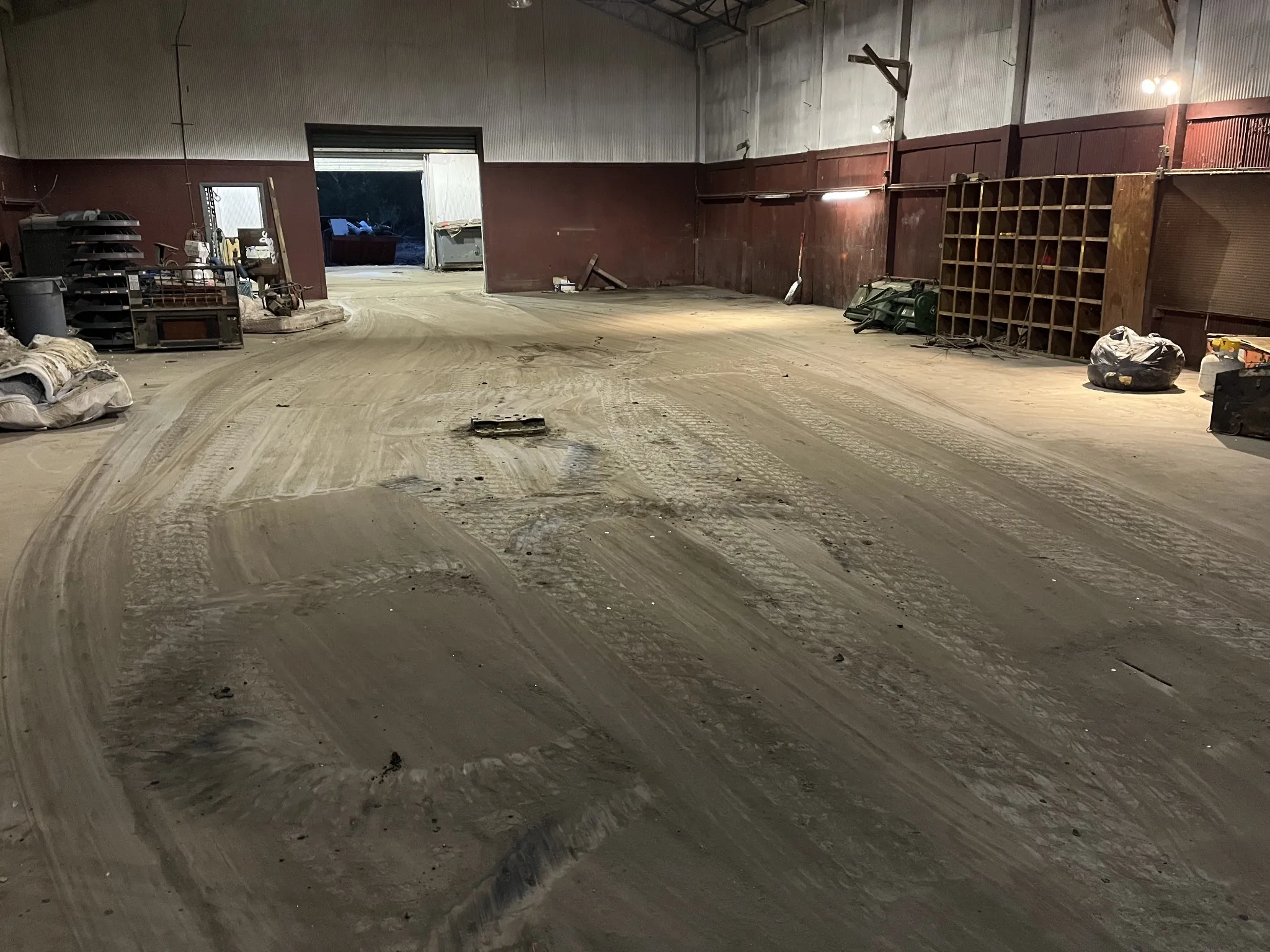
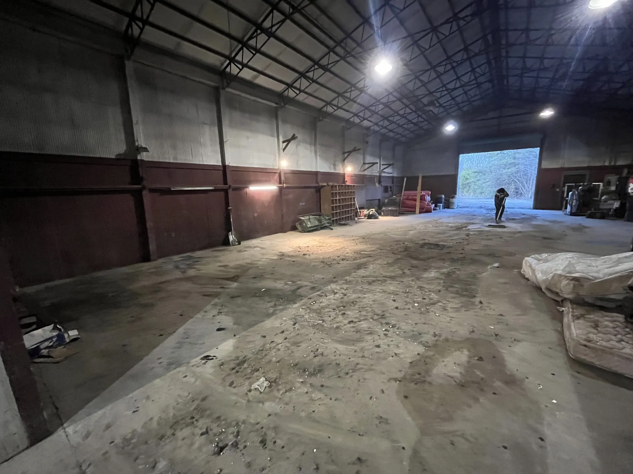
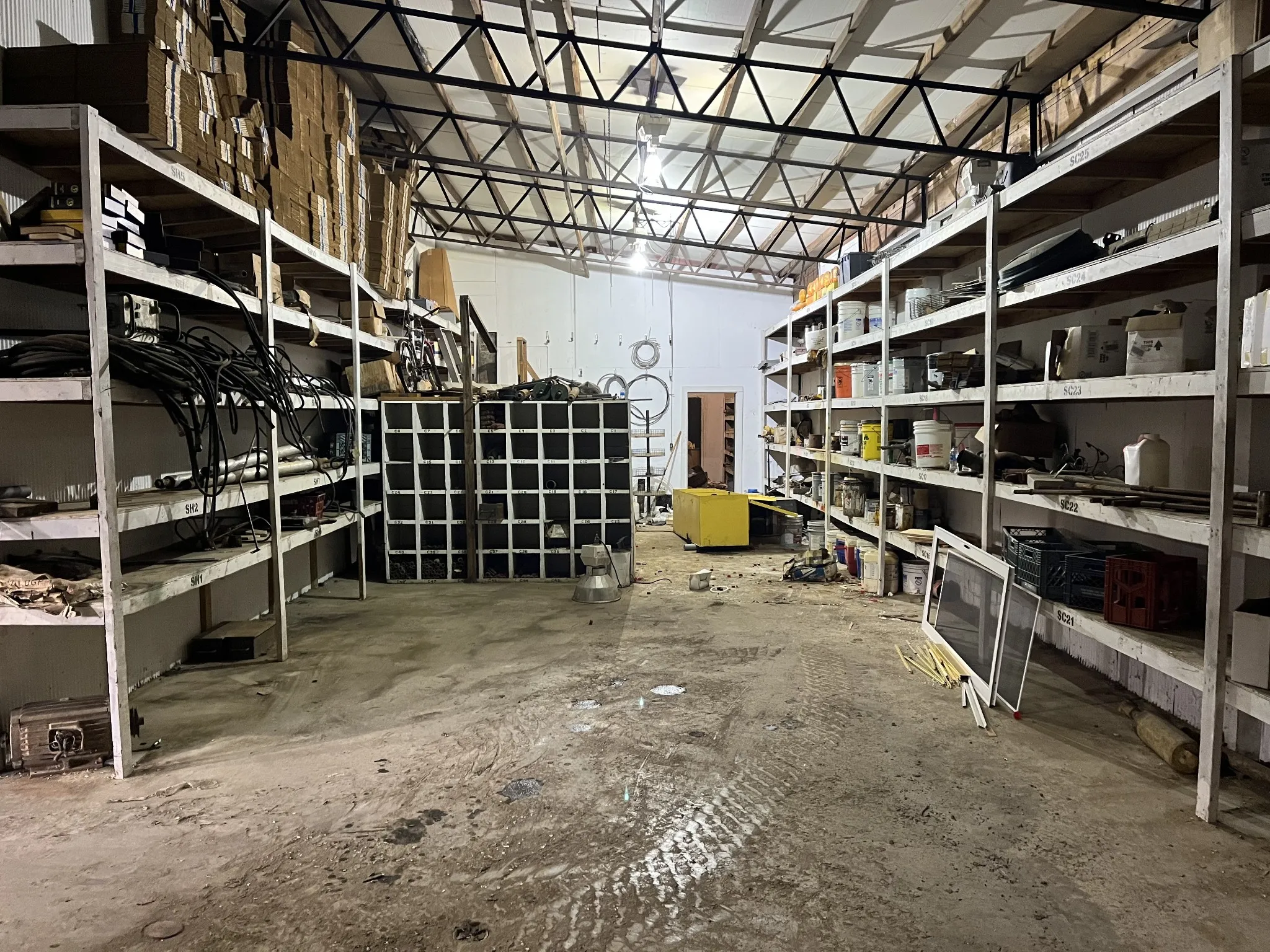
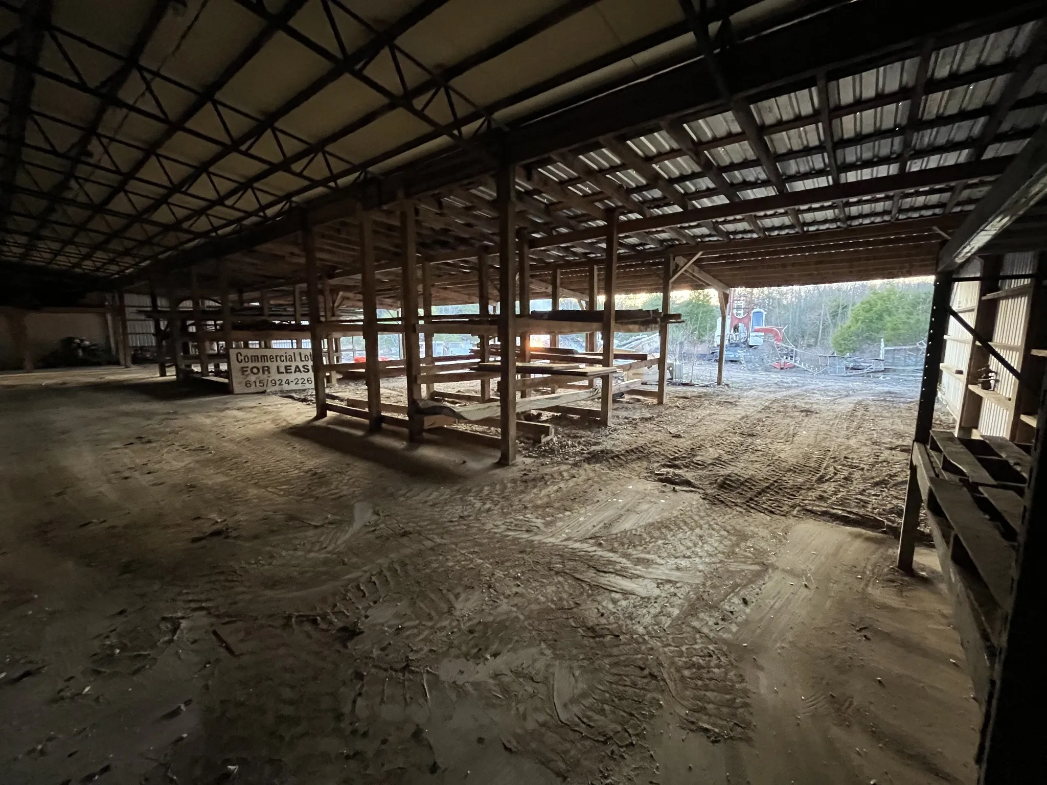
5 acres (21 acres are available) with 11,000sf building; 6,000 square-foot building totally insulated roof and walls, with concrete floor (8,000sf concrete floor). Plus a 5,000 square-foot shed attached (2,000sf of shed has insulated roof & walls plus concrete floor, easily converted into closed in space), with 3 side walls, (11,000 sf total under roof). Main building has front and back 12 foot rollup doors. 2,000 square-foot lock up room, office, bathroom. 4,000 square foot large work bays with 20 foot high ceiling. Building was built in 1995, selling as is. Property has been approved by Monteagle planning commission for R-3 zoning and RV campground development. R-3 zoning allows for residential with higher density homes, including patio homes, Apartments, condos, and in this case a campground. The building would make a great Camp Ground Center, with offices, showers, storage, laundry, recreation center, repair shop. The building could be converted into a barndomenium. 1,500 feet from Interstate 24, Exit 135. There is a city forced main sewer line located about 600 feet from this property.
- Property Type: Farm
- Listing Type: For Sale
- MLS #: 3001459
- Price: $397,711
- Lot Area: 5 Acre
- Office Name: Smoke House Realty
- Agent Name: James D. Oliver
- Listing Status: Active
- Street Number: 355
- Street: Wells Street
- City Monteagle
- State TN
- Zipcode 37356
- County Marion County, TN
- Subdivision American Shotcrete
- Longitude: W86° 10' 7''
- Latitude: N35° 13' 35.2''
- Zoning: R-3
- Directions: Beginning at interstate 24, exit 135. Travel south on Dixie Lee Highway across the interstate to Wells Street, turn right, go around Wells Street to the first driveway on the right.
-
Utilities Water Available
-
Sewer Private Sewer
- Elementary School: Monteagle Elementary
- Middle School: Monteagle Elementary
- High School: Grundy County High School
- Water Source: Public
- Levels: Three Or More
- Lot Features: Level
- On Market Date: September 24th, 2025
- Previous Price: $397,711
- Annual Tax Amount: $951
- Mls Status: Active
- Originating System Name: RealTracs
- Special Listing Conditions: Owner Agent
- Modification Timestamp: Jan 19th, 2026 @ 9:17pm
- Status Change Timestamp: Sep 24th, 2025 @ 7:46pm
Questions? Connect With Us!

MLS Source Origin Disclaimer
The data relating to real estate for sale on this website appears in part through an MLS API system, a voluntary cooperative exchange of property listing data between licensed real estate brokerage firms in which Cribz participates, and is provided by local multiple listing services through a licensing agreement. The originating system name of the MLS provider is shown in the listing information on each listing page. Real estate listings held by brokerage firms other than Cribz contain detailed information about them, including the name of the listing brokers. All information is deemed reliable but not guaranteed and should be independently verified. All properties are subject to prior sale, change, or withdrawal. Neither listing broker(s) nor Cribz shall be responsible for any typographical errors, misinformation, or misprints and shall be held totally harmless.
IDX information is provided exclusively for consumers’ personal non-commercial use, may not be used for any purpose other than to identify prospective properties consumers may be interested in purchasing. The data is deemed reliable but is not guaranteed by MLS GRID, and the use of the MLS GRID Data may be subject to an end user license agreement prescribed by the Member Participant’s applicable MLS, if any, and as amended from time to time.
Based on information submitted to the MLS GRID. All data is obtained from various sources and may not have been verified by broker or MLS GRID. Supplied Open House Information is subject to change without notice. All information should be independently reviewed and verified for accuracy. Properties may or may not be listed by the office/agent presenting the information.
The Digital Millennium Copyright Act of 1998, 17 U.S.C. § 512 (the “DMCA”) provides recourse for copyright owners who believe that material appearing on the Internet infringes their rights under U.S. copyright law. If you believe in good faith that any content or material made available in connection with our website or services infringes your copyright, you (or your agent) may send us a notice requesting that the content or material be removed, or access to it blocked. Notices must be sent in writing by email to the contact page of this website.
The DMCA requires that your notice of alleged copyright infringement include the following information: (1) description of the copyrighted work that is the subject of claimed infringement; (2) description of the alleged infringing content and information sufficient to permit us to locate the content; (3) contact information for you, including your address, telephone number, and email address; (4) a statement by you that you have a good faith belief that the content in the manner complained of is not authorized by the copyright owner, or its agent, or by the operation of any law; (5) a statement by you, signed under penalty of perjury, that the information in the notification is accurate and that you have the authority to enforce the copyrights that are claimed to be infringed; and (6) a physical or electronic signature of the copyright owner or a person authorized to act on the copyright owner’s behalf. Failure to include all of the above information may result in the delay of the processing of your complaint.
 Homeboy's Advice